

A NEW walkable map of Tavistock has been printed to encourage health and well-being and sustainable living after a community effort.
The free map is more than an outline of streets and buildings, it marks public services, community groups and gives people a clear choice of walking.
Transition Tavistock’s map of Tavistock, is available to residents and visitors through the Tavistock Visitor Information Centre and Tavistock Library.
A digital pdf document of both sides is now available to view or download from the Transition Tavistock website: https://transitiontavistock.org.uk/walkmap/.

-Val-Vine.jpeg?width=209&height=140&crop=209:145,smart&quality=75)
Transition Tavistock is a member-based voluntary democratic organisation seeking to bring the community together by sharing knowledge and practical ideas to use less energy and resources, grow more food at home and supply and buy more locally.
The goal is to help build a strong and self-supporting community for Tavistock and the surrounding areas, seizing the opportunity to bring about a more sustainable and better future.
Kit Harbottle, of TT travel action group, said: ‘The new walkable map is part of the Walkable Tavistock project within Transition Tavistock, and is now ready for use.
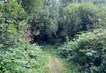
‘Parts of Tavistock are well connected and atractive to walk through. We’re trying to make it all like that and helping people make walking the natural choice for short trips.
‘Our new walkable map enables people to easily find and walk between their homes, businesses, public and community services.
‘We aim to give priority to public services and community groups which are ableto use it effectively to encourage health and wellbeing.’
The map encourages people to travel without a car and highlights traffic-free cut-throughs, bus stops and community facilities.
Routes with steps are marked differently to help people with prams and mobility aids plan their trips.
The map includes buildings colour-coded according to usage and covers Meadowlands Leisure Centre, Tavistock Guildhall, health centres, schools, churches and surgeries. Descriptions are given of open spaces off the map, such as Whitchurch Down, and of how accessible paths are for everyone.
The map was produced due to grants from Devon county and West Devon borough councils, LiveWest, the Lions Club of Tavistock and Active Devon, printed copies of this edition of the map are free.
The map is pocket-sized when folded, A3 when opened and covers the built-up area of Tavistock, and some of the surrounding open spaces. A QR code on the printed map, includes a feedback form and links to explanatory notes and relevant local links. Any queries feedback can be made through email: [email protected]
The next ‘sustainable’ event in Tavistock is The Great Big Green Week is in June, from Saturday 10 to Sunday 18.
Comments
This article has no comments yet. Be the first to leave a comment.